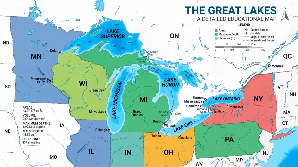
The Great Lakes are among North America’s most recognizable natural landmarks, forming the largest group of freshwater lakes on Earth by surface area. Whether you’re a student, traveler, geography enthusiast, teacher, or map collector, a Great Lakes map with names helps visualize the unique relationship between these massive bodies of water and the surrounding regions.
From the vast waters of Lake Superior to the iconic shape of Lake Michigan, each lake has its own identity, history, and geographical significance. Understanding their locations and names makes maps easier to read and transforms a simple geographic reference into a fascinating story of nature, culture, and exploration.
Featured Snippet
The Great Lakes are five large freshwater lakes in North America: Lake Michigan, Lake Huron, Lake Erie, and Lake Ontario, along with Lake Superior. Together, they form one of the world’s largest freshwater systems and are located along the United States–Canada border, except for Lake Michigan, which lies entirely within the United States.
Great Lakes at a Glance
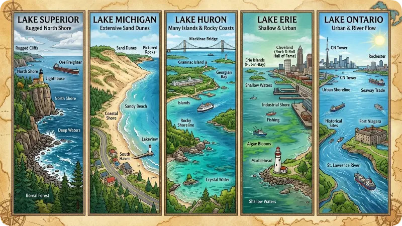
| Great Lake | Known For | Borders |
| Lake Superior | Largest and deepest | Minnesota, Wisconsin, Michigan, Ontario |
| Lake Michigan | Only lake entirely in the U.S. | Michigan, Wisconsin, Illinois, Indiana |
| Lake Huron | Extensive shoreline | Michigan, Ontario |
| Lake Erie | Shallowest Great Lake | Michigan, Ohio, Pennsylvania, New York, Ontario |
| Lake Ontario | Gateway to the Atlantic | New York, Ontario |
Understanding a Great Lakes Map With Names
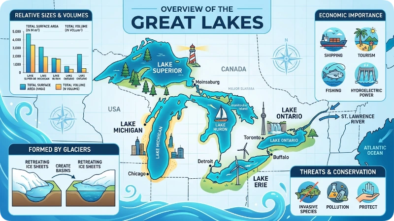
A labeled Great Lakes map allows readers to quickly identify each lake and understand how they connect.
When viewed from west to east:
- Lake Superior appears at the top.
- Lake Michigan extends southward.
- Lake Huron sits east of Michigan.
- Lake Erie lies further south and east.
- Lake Ontario occupies the eastern edge of the system.
This arrangement creates one of the most recognizable geographic patterns in North America.
Why Named Maps Matter
A map with clearly labeled lake names helps:
- Improve geography learning
- Support classroom education
- Assist travelers planning routes
- Enhance historical understanding
- Provide context for environmental studies
Named maps are particularly valuable because many people recognize the shape of the lakes but struggle to identify each one individually.
The Five Great Lakes Explained
Lake Superior
Lake Superior is often considered the “giant” of the Great Lakes.
Vibe: Powerful, remote, untamed
Highlights:
- Largest freshwater lake by surface area in the world
- Deepest Great Lake
- Famous for rugged shorelines and dramatic scenery
- Popular among outdoor adventurers
When viewed on a map, Lake Superior dominates the northern section of the Great Lakes region.
Lake Michigan
Lake Michigan is arguably the most recognizable lake due to its distinctive shape.
Vibe: Iconic, energetic, urbanmeetsnature
Highlights:
- Only Great Lake entirely within the United States
- Home to major cities including Chicago
- Known for sandy beaches and tourism
- Popular in travel photography
On maps, its long northsouth orientation makes it easy to identify.
Lake Huron
Lake Huron features one of the world’s longest freshwater shorelines.
Vibe: Peaceful, scenic, coastal
Highlights:
- Contains thousands of islands
- Connected to Lake Michigan through the Straits of Mackinac
- Rich maritime history
- Popular for boating and waterfront communities
Its intricate coastline makes it particularly interesting on detailed maps.
Lake Erie
Lake Erie may be the shallowest Great Lake, but it plays a major role economically and environmentally.
Vibe: Accessible, vibrant, productive
Highlights:
- Warmest Great Lake
- Supports major fisheries
- Important shipping route
- Popular recreational destination
On maps, Lake Erie appears as a relatively long and narrow body of water.
Lake Ontario
Lake Ontario serves as the eastern gateway of the Great Lakes system.
Vibe: Historic, sophisticated, international
Highlights:
- Connects to the Atlantic Ocean through the St. Lawrence River
- Supports major population centers
- Important trade corridor
- Rich cultural and historical significance
It appears at the far eastern edge of most Great Lakes maps.
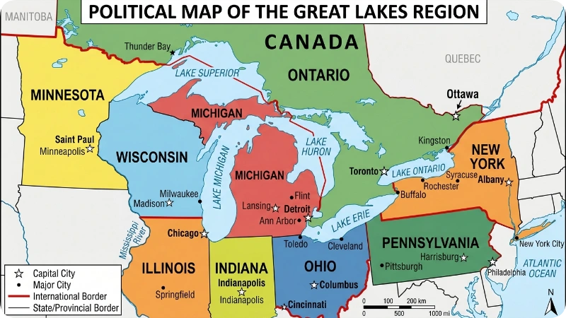
States and Provinces Found on Great Lakes Maps
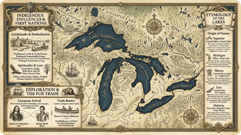
U.S. States
Many labeled maps also identify:
- Michigan
- Wisconsin
- Minnesota
- Illinois
- Indiana
- Ohio
- Pennsylvania
- New York
Canadian Province
Most Great Lakes maps also label:
- Ontario
Understanding these surrounding regions helps readers place the lakes within a broader geographic context.
Great Lakes Name Origins
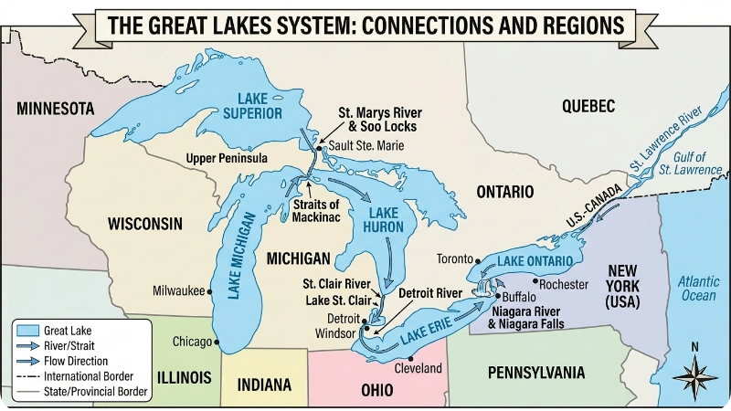
The names of the Great Lakes reflect centuries of exploration, Indigenous history, and cultural influence.
| Lake | Origin |
| Superior | Named for its position above Lake Huron |
| Michigan | Derived from an Indigenous word meaning “large lake” |
| Huron | Named after the Huron people |
| Erie | Named after the Erie people |
| Ontario | Derived from an Indigenous term meaning “beautiful lake” or “great lake” |
These names add cultural depth to maps and help tell the story of the region.
Different Types of Great Lakes Maps
Educational Maps
Perfect for classrooms and students learning North American geography.
Political Maps
Show borders, cities, states, and provinces.
Physical Maps
Highlight terrain, elevations, and natural features.
Historical Maps
Reveal how explorers and early settlers viewed the region.
Travel Maps
Focus on attractions, parks, beaches, and scenic routes.
Each type serves a different purpose, making labeled Great Lakes maps useful for multiple audiences.
Fun Facts About the Great Lakes
- Together, the Great Lakes contain roughly 20% of the world’s surface freshwater.
- The shoreline is longer than the coastlines of many countries.
- More than 30 million people live within the Great Lakes basin.
- Lake Superior contains enough water to cover North and South America with about a foot of water.
- The lakes support major shipping, tourism, recreation, and fishing industries.
These facts make Great Lakes maps more engaging and memorable.
Why Great Lakes Maps Remain Popular
In the age of GPS and digital navigation, traditional maps still offer something special.
A labeled Great Lakes map helps people:
- Visualize geography at a glance
- Understand regional relationships
- Appreciate natural landmarks
- Learn history and environmental science
- Plan travel adventures
The names transform a collection of blue shapes into a connected story of landscapes, communities, and cultures.
Frequently Asked Questions
What are the names of the five Great Lakes?
The five Great Lakes are Lake Superior, Lake Michigan, Lake Huron, Lake Erie, and Lake Ontario.
Which Great Lake is the largest?
Lake Superior is the largest Great Lake by surface area.
Which Great Lake is entirely in the United States?
Lake Michigan is the only Great Lake located completely within the United States.
Why are labeled Great Lakes maps useful?
They help identify each lake, understand geography, support education, and improve mapreading skills.
Which Great Lake is farthest east?
Lake Ontario is the easternmost of the five Great Lakes.
Are the Great Lakes connected?
Yes. The five lakes are connected through rivers, channels, and straits, forming an integrated freshwater system.
Conclusion
A Great Lakes map with names does far more than identify five bodies of water. It provides a window into one of the world’s most remarkable fresh water systems. Each lake has a distinct personality, geographic role, and historical story, making labeled maps valuable for students, travelers, educators, and geography enthusiasts alike.
Whether you’re studying North American geography, planning a road trip, or simply exploring the region from home, understanding the names and locations of Lake Superior, Lake Michigan, Lake Huron, Lake Erie, and Lake Ontario brings the Great Lakes to life in a meaningful way

Emma helps authors, screenwriters, and gamers find the perfect names for their fictional characters. She analyzes historical trends and linguistic styles to craft names that carry deep meaning. When she isn’t writing, she loves plotting her next fantasy novel at a local café.